PROJECT GOALS AND STRATEGY
Introduction
Tel Lachish is the key site for understanding the development and expansion of the Kingdom of Judah to the south and west of Jerusalem. During earlier expeditions, four Iron Age layers were uncovered. Levels V and IV are traditionally dated to the late 10th and the ninth centuries BCE. Layers III and II are traditionally dated to the eighth and seventh centuries BCE. Since the third expedition, several debates and trends have arisen concerning the nature and chronology of the rise of the Israelite State and Iron Age ceramic chronology. These new trends have dated Levels V and IV to the eighth century BCE, yet only Layers III and II were excavated on a relatively large scale. The earlier sequence at this site is not altogether clear. Questions remain about the following issues: (1) the absolute date of Levels V and IV, (2) the type of settlement, (3) administration, (4) cult, (5) writing, and (6) urban development.
The recent debate of the past two decades over the low chronology, which relates the rise of the Kingdom of Judah to the eighth century BCE, is based, in part, on the radiometric data from northern sites (Dor, Megiddo, Jezreel, and Rehov), which have little bearing on the history of Judah. Given these new questions and problems posed today, long after the conclusion of the latest Lachish expedition, renewed excavations are called for focusing on a specific period in the history of Lachish: the late 10th and the early ninth centuries BCE.
Research Questions
Research Questions
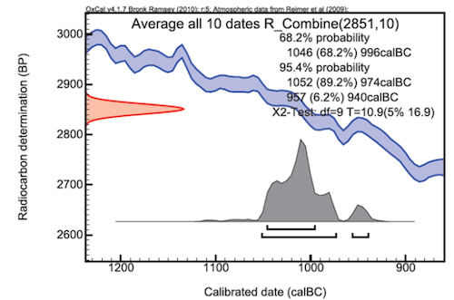
The relationships of ceramic typology and dating are tested by combining the results of a number of sites in the region. Conclusions are also based largely on settlement patterns which rely on survey results. Recent excavations at Khirbet Qeiyafa have shown that survey results do not always providea complete picture of the occupational history of a site. Until stratigraphic excavations are conducted at Tel Lachish the question of occupation history may never be resolved. By focusing specifically on Layers V and IV, from a stratigraphic perspective, and procuring 14C dates (sent to Oxford University) for these periods of occupation, the chronology of this important site can be better established and provide answers to the ongoing debate about the overall chronology of the Iron Age.
Regional and National Development and Relationships
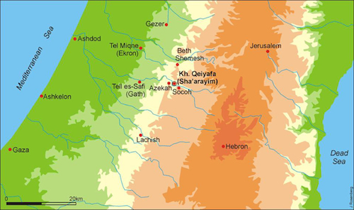
The excavation will seek to integrate other developments at neighboring sites, like Khirbet Qeiyafa, seeking to understand the early history of Judah. How did these sites develop? Did Lachish exist simultaneously with other sites in the Shephelah, or was there a pattern of chronological development, a kind of see-saw effect that has been documented in Philistia? How do the material culture and architecture compare at the different sites and in what way are they similar or dissimilar? The advantage of having several excavation projects develop simultaneously allows for this kind of comparison and development. Finally, how does the foundation and development of Lachish in the 10th and ninth centuries BCE relate to the greater expansion of the territory of Judah?
Procedures, Methods, and Techniques
Excavation Areas and Goals
Although the central and southern areas at Lachish have been extensively examined by previous expeditions, no substantial remains were uncovered from Level IV and Level V. The great city of Layer III covered an area of nearly 20 acres. The earlier cities were probably much smaller and may have been spread only over an area of only five or six acres. When Yohanan Aharoni excavated in the northeast part of the site, he found some impressive architecture and some rich finds from Levels IV and V. On this basis, Area A is located adjacent to Yohanan Aharoni’s excavation. In the brief 2013 season Level II was exposed, with a rich destruction from the end of the First Temple period (586 BCE). In a limited area we found a group of complete pottery vessels. Area A will be expanded over the next three season for a large horizontal exposure.
Area B is located on along the northeastern edge of the site. Inside a large circular depression, one square was excavated down a little more than 2.5 m. No architecture or floor levels were found, only two layers of fill. In the upper fill we recovered relatively large quantities of pottery sherds, while only a few sherds were found in the lower part of the fill. David Ussishkin has suggested that the large round depression was created in 701 BCE when soil was taken to build a counter-ramp inside the city to protect it from the Assyrian siege ramp outside the city. Saar Ganor, of the Israel Antiquities Authority, conjectures that a water system may have been dug here, down to the water table. We will conduct a geophysical survey in December, which might reveal more about this enigmatic location at Tel Lachish.
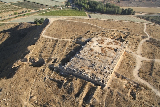
At the northeast corner of Lachish in Area B, adjacent to the deep well uncovered during the British expedition, the fortification systems will be examined. This part of the site is closest to the river and features a path leading to the top of the tel. This is an ideal location for a city gate. In the 1930s the British expedition excavated this slope, but the results of this operation were never published. In 2013, the vegetation was cleaned and a number of massive stones and a mudbrick wall was re-exposed. The area exhibits a complex history of building and re-building. This area will be enlarged and excavated to get a complete sequence of the Iron Age history of the site, from Level II to Level V.
Area C will be located halfway up the slope where some monumental architecture is visible from the surface.
The results from Khirbet Qeiyafa, together with the results from Lachish, will provide a clearer and more complete picture of the early history of the Kingdom of Judah in the 10th and ninth centuries BCE. We view these two excavations as one regional project.
Excavation Methodology
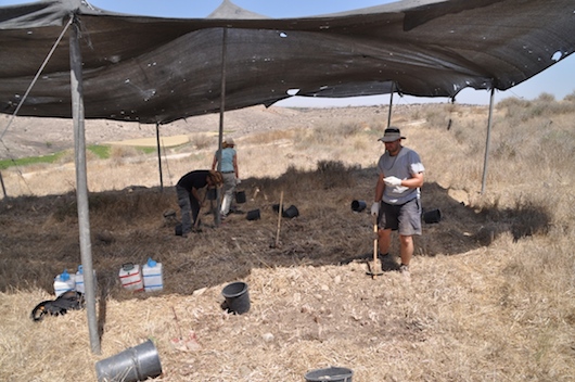
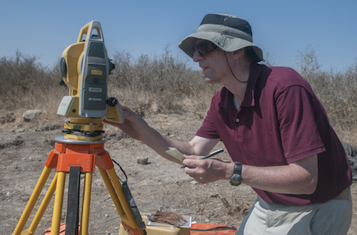
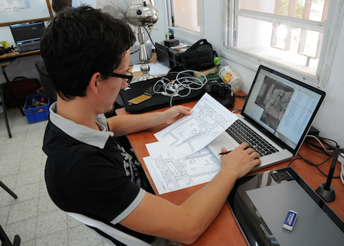
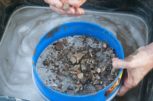
Each square is supervised by a trained archaeologist and three to four volunteers. This high ratio of staff to volunteers ensures careful excavation and documentation. All collapsed sediments above floors are sifted in a two-mm mesh in order to retrieve small finds such as seals, scarabs, beads, bone artifacts, and small metal objects. Micro-fauna bones (two to three mm) are collected by wet sifting in a one-mm mesh. The stratigraphic method is employed with a commitment to wide horizontal exposure, retaining 5 x 5 m squares and one-meter balks. The bulks are necessary for four reasons: (1) maintaining the grid for the three-dimensional measurement of all features, architecture, and objects using a Topcon Total Station; (2) the daily digital production of top plans for each square with locus numbers and elevations using ArcGIS, Adobe Photoshop and Illustrator software; (3) stratigraphic control; and (4) transporting buckets of dirt and stone to the dump area. Balks are systematically trimmed and maintained. Once floors are reached in the area, the balks are drawn, and final photos are taken of all the balks and the square itself. The balks are then stratigraphically removed. By the end of the season, the architectural units are fully exposed, thus achieving the overall aim of the excavation.
Survey and Recording Technologies
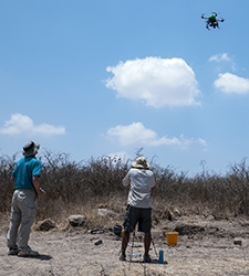
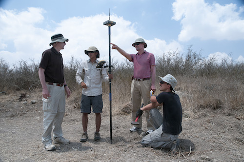
Using the latest in site survey technology with a Topcon DGPS RTK receiver and an additional Topcon Total Station, daily digital top plans are produced through georeferencing software (ArcGIS). In 2013 a HoverFly quadcopter was employed for daily aerial photographs and video. Data is entered on ASUS tablet computers in each square on the CIRC electronic database system developed by Southern Adventist University’s School of Computing. At the end of the season locus sheets are printed, stratigraphic summaries prepared, and a complete notebook with a copy of all digital photographs is submitted to the Israel Antiquities Authority.
Interdisciplinary Research
The project will be enlisting numerous experts in various fields as technical consultants and also as collaborators in providing a varied approach to the research problems. Experts in various disciplines have agreed to serve as technical consultants and staff as can be seen in the list below. One of the essential aspects of the excavations at Lachish will be wet sifting for bullae, inscriptions, and seals.
